Gunung Cheroh, The Historic Mountain of Kinta
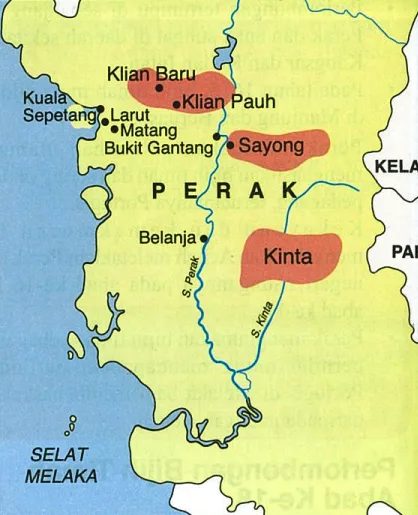
Gunung Cheroh is a historic site linked to the origin of the name Kinta. It is located in Mukim Ulu Kinta, Kinta District, Perak Darul Ridzuan. At the foot of this mountain, there are fascinating limestone caves. Additionally, it is situated adjacent to the Kinta River.
Previously, Gunung Cheroh was part of Kampung Kepayang, Fair Park, Ipoh. The village's area extended from Gunung Cheroh to Gunung Matsurat. The distance between these two mountains is approximately 3km. Today, Gunung Cheroh has been excluded from the village boundaries due to several local factors, while Gunung Matsurat remains part of Kampung Kepayang, Fair Park, Ipoh.

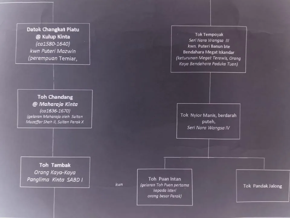
Once upon a time, there was a legend about Toh Changkat Piatu, the son of the 2nd Sultan of Perak, Sultan Mansur Shah I, from his marriage to an Orang Asli (Tok Batin) girl of the Semang tribe at the mouth of the Kinta River. Toh Changkat Piatu and his followers sailed down the Kinta River. During their voyage, they experienced something strange while passing through the limestone mountain area of Gunung Cheroh. The distance between Gunung Cheroh and the mouth of the Kinta River is about 100 km by river. As the story goes, the boat they were on could not continue its journey upon reaching the foot of Gunung Cheroh because the path was narrow and shallow.
At the edge of Gunung Cheroh, they heard a rhythmic chiming sound like bells and stopped. Suddenly, a flying lizard jumped into the water to cross. Every time the lizard stopped, the chiming rhythm vanished. Toh Changkat Piatu then said, "Listen to that, this river shall be named 'Genta' (Bell), because of that sound." Then the flying lizard disappeared along with the chiming sound. One night, Toh Changkat Piatu, who led the voyage, dreamt of being visited by the guardian spirit of Gunung Cheroh. In the dream, the guardian spirit gave his blessing to use the name 'Genta' and told Toh Changkat Piatu that he and his descendants would one day become the Orang Besar Kinta (Great Chiefs of Kinta). Following this dream, Toh Changkat Piatu chose the name 'Kulop Genta' or 'Kepala Genta' as his title and decided to settle there with his followers.

Following the dream, Toh Changkat Piatu chose the name Kulop Genta as his title and decided to settle there with his followers. He married an Orang Asli (Tok Batin) girl of the Temiar tribe named Puteri Mazwin. The marriage between the descendants of Toh Changkat Piatu and the descendants of Toh Senongsa Seri Nara Wangsa, who ruled around Ulu Kinta (centered in Kampung Kepayang, Fair Park, Ipoh), created the title Panglima Kinta Seri Amar Bangsa DiRaja. This title became one of the Orang Besar Lapan (Eight Great Chiefs) in the Perak Sultanate's monarchy system to this day.
The influence of Jawi script caused the word 'Genta' to be pronounced as 'Kinta', further aided by European adaptation of the word since the 18th century. 'Kinta' is also believed to be the local Chinese pronunciation, which the British used as a reference for official and unofficial documentation. The word 'Genta' eventually continued to be pronounced and written as 'Kinta' to this day.
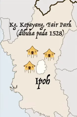
According to elders, in the past, there was a port near Gunung Cheroh governed by Toh Senongsa Seri Nara Wangsa (one of the Orang Besar Enam Belas), who was the captain for the Panglima Kinta Seri Amar Bangsa DiRaja. Its location was highly strategic as the main entry point to Kampung Kepayang, Fair Park, Ipoh via the Kinta River. At that time, Kampung Kepayang, Fair Park, Ipoh was the administrative center for the Kinta 'District'. Toh Senongsa Seri Nara Wangsa was responsible for managing all trade passing through this route on behalf of the Panglima Kinta Seri Amar Bangsa DiRaja, including the collection of trade taxes.

Efforts to restore Gunung Cheroh into the boundary of Kampung Kepayang, Fair Park, Ipoh are now a key agenda among local community leaders as part of an effort to preserve and rebrand Malay historical and heritage values in Ipoh City, particularly in Kampung Kepayang, Fair Park, Ipoh. This is important to ensure the continuity of Malay history and heritage in Ipoh City can be improved and commercialized to be passed down to future generations, while also serving as a tourist attraction for Ipoh City. Main sources:
- "Salasilah Keturunan Panglima Kinta Seri Amar Bangsa DiRaja (Pasak Paloh - Pasak Kepayang)", compiled by Fazil Shuhaimi Talib, published by Persatuan Keluarga Kulop Kinta (PK3)
- "Riwayat Kinta", written by Abdul Talib Ahmad, published by Pustaka Rusna
- "Titles and Ceremonial Traditions of the Royalty and Nobility of the State of Perak, Malaysia", written by Dr. Adib Vincent Tung, published by Perak Academy
- "Kenali Kampung Kepayang", directed by Mukriz Mahader, produced by Astro Awani
- "Kinta Valley: Pioneering Malaysia's Modern Development", written by Abdur-Razzaq Lubis and Salma Nasution Khoo, published by Perak Academy.